App Detial
CTUC Ocotillo Wells SVRA
Seller: Friends of JawbonePrice: -1


Download CTUC Ocotillo Wells SVRA free via AppsHawk.
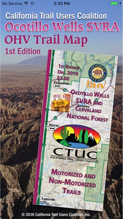
The CTUC Ocotillo Area Trail Map App brings the popular 1st print edition CTUC Ocotillo and Surrounding Areas Trail Map to your iPhone, iPad or iPod Touch.
View the map in several zoom levels and navigate to popular destinations throughout the area. The map covers 1.5 million acres of world-class OHV recreation lands from the popular Ocotillo Wells SVRA to the famous Cleveland National Forest. Depicted on the map are hundreds of miles of legal, designated OHV roads and trails, as well as OHV Areas, wilderness areas, State Parks, historic military sites, and other public and private lands.
The map features OHV routes managed by the Bureau of Land Management's El Centro and Palm Springs Field Offices, Salton Sea National Wildlife Refuge, Ocotillo Wells SVRA, Laguna Mountain Recreation Area, Salton Sea State Recreation State, and Anza-Borrego Desert State Park.
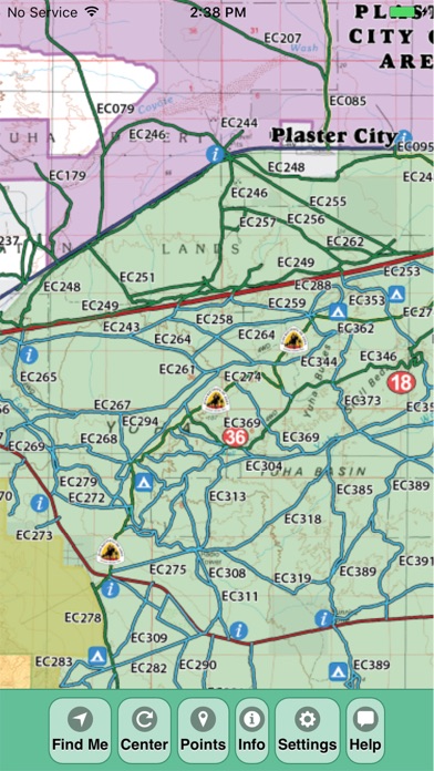
Featured within the app are:
√ OpenStreetMap background layer can be turned on or off
√ Zoom and scroll across the map
√ Find your location (iPhones and cellular iPads only)
√ Track your movement across the map (iPhones and cellular iPads only)
√ Find and navigate to 36 back country destinations and points of interests
√ Obtain emergency and other contacts
√ Find local services such as fuel, lodging and food
√ Learn area OHV rules, regulations, and safety tips
√ Legend of symbols on the map
Screens