App Detial

Panamint Map App
Seller: Friends of JawbonePrice: -1


Download Panamint Map App free via AppsHawk.
The FOJ Panamint Valley OHV Trail Map App brings the new 1st Edition FOJ Panamint Valley OHV Trail Map to your iPhone, iPad or iPod Touch.
View the map in several zoom levels and navigate to your favorite Panamint Valley destinations. Such destinations include: Ballarat, a city named after the first and only gold rush town in Australia, Leadfield Ghost Town, an abandoned lead and copper claim that lays decrepit and unused, along with many more destinations. Depicted on the maps are hundreds of miles of legal, designated OHV roads and trails, as well as wilderness areas, Death Valley National Park, military bases, and other public and private lands.
The maps features OHV routes managed by the Bureau of Land Management’s Ridgecrest Field Office, Death Valley National Park, and Eastern Sierra Interagency Visitor Center.
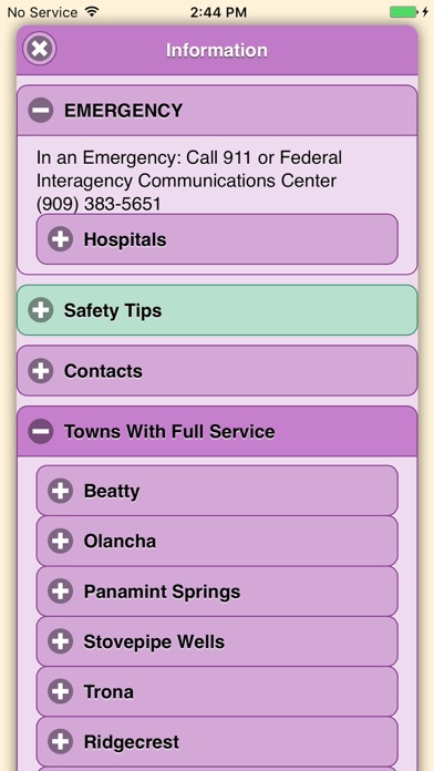
Featured within the app are:
√ OpenStreetMap background layer can be turned on or off
√ Zoom and scroll across the map
√ Find your location (iPhones and cellular iPads only)
√ Track your movement across the map (iPhones and cellular iPads only)
√ Find and navigate to 43 back country destinations and points of interests
√ Obtain emergency and other contacts
√ Find local services such as fuel, lodging and food
√ Learn area OHV rules, regulations, and safety tips
√ Legend of symbols on the map
Screens